
Begin with the [photogenic] end in mind
Planners and engineers need to visualize the future human experience of their infrastructure improvements.

On a whole bunch of Saturdays growing up, my family had Slide Show Night when I was growing up. Either my sister or I would be in charge of setting up the projector, the screen, and loading the carousel. During the show, there’d be a few landscape shots or skylines that were taken during vacations, but almost all the shots were up close (faces, gestures, decorations, etc.).
Before we were driving age, my sister and I were given our own cameras as Christmas gifts. We’d spend our own money buying and developing film. We basically documented our Gen X life: playing in the woods, sledding, beach trips, birthday parties, and even selfies. (I shot a 24-exposure roll of me stupidly rock climbing in regular clothes and treadless high-tops on Pikes Peak in Colorado.)
Years later, when I graduated college and started working on transportation studies, that same camera came with me. It seemed natural to shoot study areas before and after team meetings. When I’d put together slide shows to document the work we did, I kept noticing two distinct types of picture: the charming local ingredient (e.g. historic train caboose), and the oppressive transportation ingredient (e.g. wide arterial with turn lanes on all corners).
I’d look at those pictures and recall how dangerous it felt getting those shots to document the transportation “improvements.” My industry of highly educated professional planners and engineers was defining success in ways that didn’t make sense when you looked at the pictures I took of the study areas. Infrastructure projects were being executed in ways that prevented residents and visitors from taking a comfortable walk around town.
Plan for picture-worthy memories.
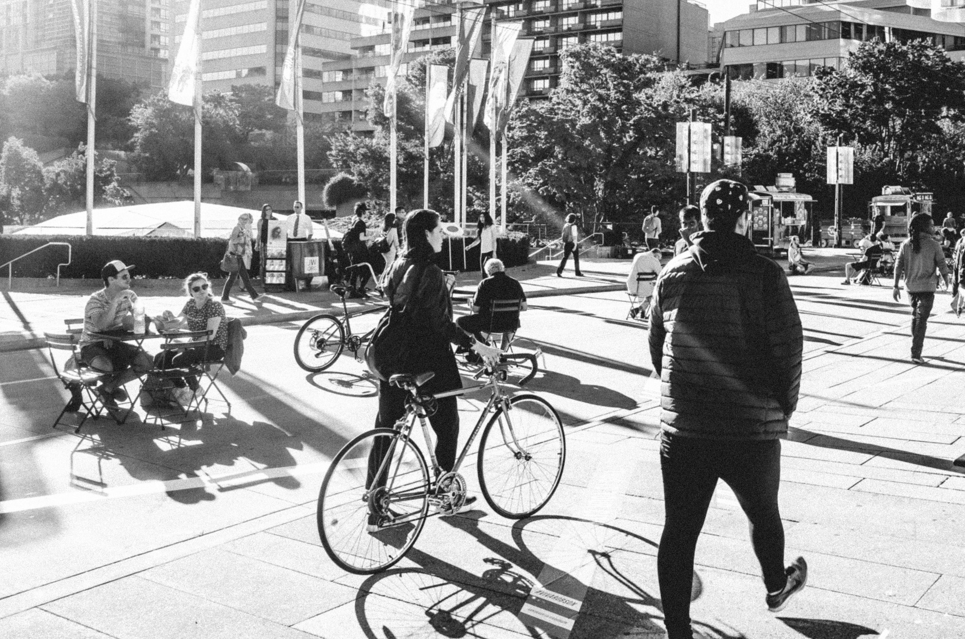
What is it about a place that makes people reach for a camera, hang out, spend money, and keep coming back? The status quo experts aren’t asking questions like that. Instead, they’re focused on technical requirements and processes that don’t consider what the average person is looking for: a bench in the shade, a fountain, or a plaza for people-watching.
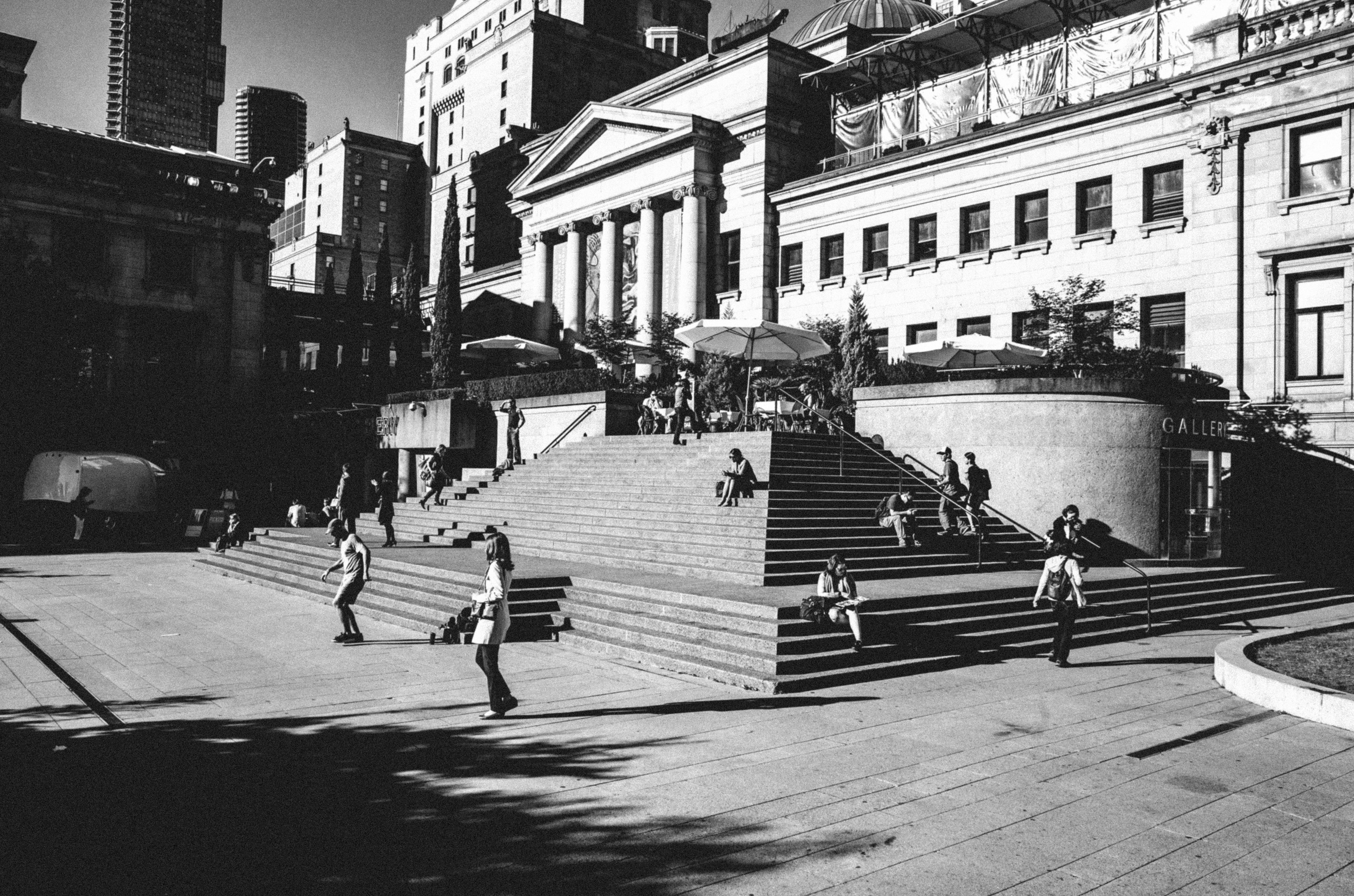
Professionals create infrastructure that makes or breaks bonds between friends, families, and strangers. It’s paramount to understand the context of our work. Town planners and engineers have the opportunity to turn ordinary studies into recipes for creating places that are loveable, enticing, and even irresistible.
If you make decisions according to industry norms, your downtown will be easy to resist, because it’ll be entirely oriented around motor vehicle traffic rather than memorable human experiences. Regulations and permitting are anchored to car-oriented engineering, and that anchor weighs down our communities.
People across generations want walkable, bikeable downtowns. Millennials want them. Baby Boomers want them. Surveys consistently show communities of all types have an appetite for walkable, bikeable places. These are the places we see on family Slide Show Night or the modern social media equivalent.
Encourage your local leaders to plan infrastructure for slideshow-worthy human experiences. Consider how people of all ages are going to interact with each other and with their environment, and then (only then!) design the infrastructure. The internet is loaded with friendly people who would love to exchange ideas with you about irresistible places.
As legendary musician Frank Zappa said, progress requires deviation from the norm. That absolutely applies to planners and engineers working to create lovable, enticing downtowns.
I recently saw slide-show worthy photos of urban streetscapes, Toronto, circa 1955 ( judging by the cars, of all things ).
What struck me was the number of people walking in front of stores. Hundreds, in any photo. You know the images - it could be New York or Chicago.
Look closely. There were roll down fabric awnings to create shade for the pedestrians, possibly occasional shelter from the rain.
The awnings were over public sidewalks. Toronto invoked permits and annual licenses. At some point, it was easier to just not install or replace fabric awnings. The streetscape suffered.
Every rule has a consequence. Intended, or not.
So yes, visualize the end of an urban plan with a photo. Great idea.